
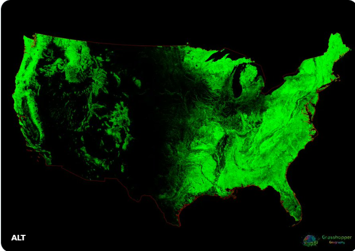
A lot a detailed information packed into this very cool map. You’ve frequently heard me say, “we live on the edge of the west.” You can really see that here, the western edge of the Ouachitas and Ozarks clearly the transition zone to the prairies to the west. The less dense green to the immediate west is the cross-timbers, trees and grass interspersed. Love this graphic.
Via Twitter: